


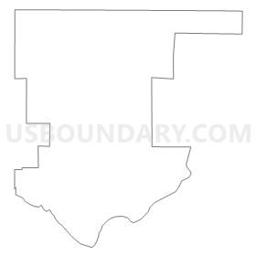
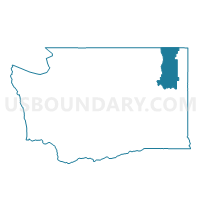
Walkers Prairie Voting District, Stevens County, Washington
About
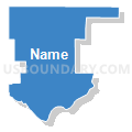
Outline
Summary
| Unique Area Identifier | 689541 |
| Name | Walkers Prairie Voting District |
| County | Stevens County |
| State | Washington |
| Area (square miles) | 61.55 |
| Land Area (square miles) | 59.56 |
| Water Area (square miles) | 1.98 |
| % of Land Area | 96.78 |
| % of Water Area | 3.22 |
| Latitude of the Internal Point | 47.89736260 |
| Longtitude of the Internal Point | -117.79392960 |
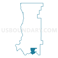
Maps

Graphs
Select a template below for downloading or customizing gragh for Walkers Prairie Voting District, Stevens County, Washington


Neighbors
Neighoring Voting District (by Name) Neighboring Voting District on the Map
- Voting District 7007, Spokane County, WA
- Voting District 7008, Spokane County, WA
- Camas Voting District, Stevens County, WA
- Clayton 2 Voting District, Stevens County, WA
- Tum Tum 1 Voting District, Stevens County, WA
- Water: Spokane River, Lincoln County, WA
- Wellpinit Voting District, Stevens County, WA
- Williams Valley Voting District, Stevens County, WA
Top 10 Neighboring County Subdivision (by Population) Neighboring County Subdivision on the Map
- Airway Heights CCD, Spokane County, WA (13,183)
- Loon Lake CCD, Stevens County, WA (10,651)
- Davenport CCD, Lincoln County, WA (4,858)
- Spokane Reservation CCD, Stevens County, WA (2,094)
Top 10 Neighboring Unified School District (by Population) Neighboring Unified School District on the Map
- Deer Park School District, WA (10,849)
- Nine Mile Falls School District, WA (8,720)
- Reardan-Edwall School District, WA (4,260)
- Mary Walker School District, WA (3,206)
- Davenport School District, WA (3,002)
- Wellpinit School District, WA (1,116)
Top 10 Neighboring State Legislative District Lower Chamber (by Population) Neighboring State Legislative District Lower Chamber on the Map
Top 10 Neighboring State Legislative District Upper Chamber (by Population) Neighboring State Legislative District Upper Chamber on the Map
Top 10 Neighboring 111th Congressional District (by Population) Neighboring 111th Congressional District on the Map
Top 10 Neighboring Census Tract (by Population) Neighboring Census Tract on the Map
- Census Tract 9514, Stevens County, WA (7,781)
- Census Tract 104.02, Spokane County, WA (6,937)
- Census Tract 9513, Stevens County, WA (4,287)
- Census Tract 9602, Lincoln County, WA (3,115)
- Census Tract 9410, Stevens County, WA (2,094)
Top 10 Neighboring 5-Digit ZIP Code Tabulation Area (by Population) Neighboring 5-Digit ZIP Code Tabulation Area on the Map
- 99006, WA (11,946)
- 99026, WA (9,042)
- 99013, WA (1,785)
- 99110, WA (1,667)
- 99173, WA (1,532)
- 99034, WA (209)